|
|
|
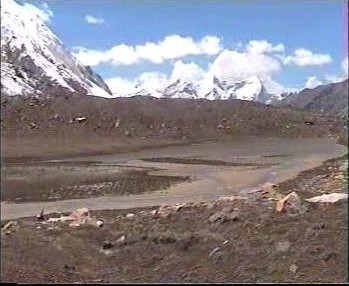
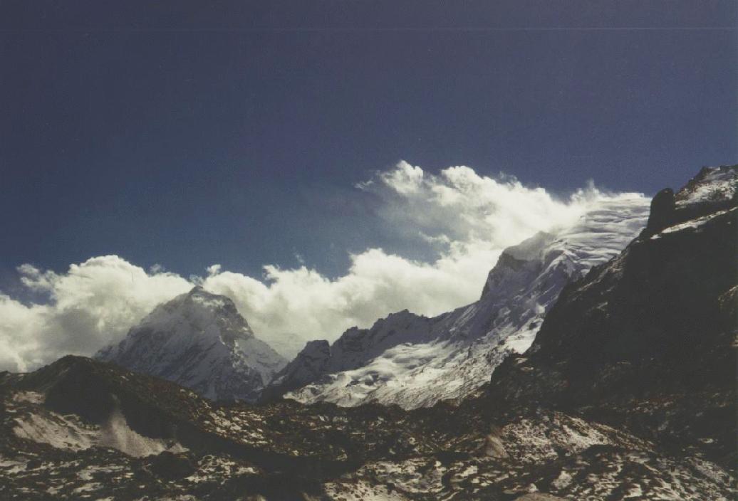
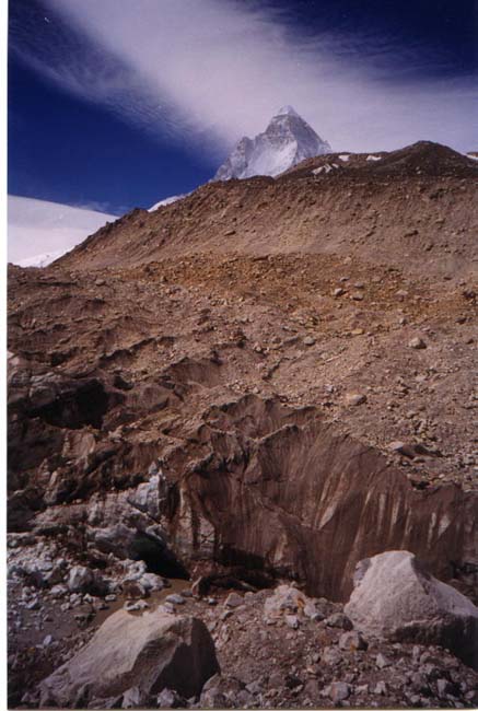
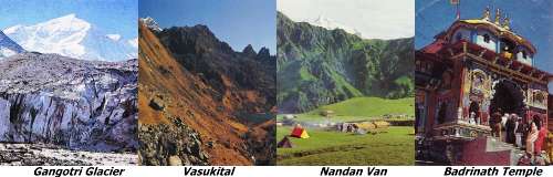
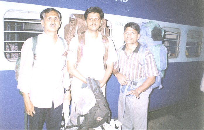
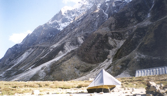
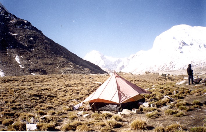
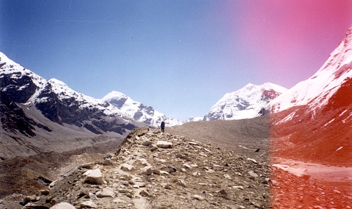
By Rajan Rikame, 10th June 2001 Dear Friends, we had an achievement to publish here under the banner of "Bhramanti.com" that we successfully completed high altitude trekking expedition from Gangotri to Badrinath. Also a feather in our cap that we climbed Kalindi peak above 20200ft for the first time. We were initially 3-member team which later became two. Leader-Rajan Rikame (myself), Equipment Incharge-Milind Gyani and Food Incharge-Sanjay Desai. Final two were myself and Milind who completed the expedition and the peak. We had taken help from local (Uttarkashi) agency especially for inner line permission, guide/porters/cook, and equipment. Geographical map of the trek route is linked here. We crossed Gangotri Glacier, Chaturangi Glacier, Sundar Glacier, Suryalaya Glacier, Seta Glacier, Kalindi Glacier (total 6 glaciers). All our camps were base of some or other peaks like Shivling(Tapovan), Bhagirathi(Nandanban), Vasuki(Vasuki Tal), Satopanth, Chandra Parbat(Seta Glacier), Kalindi(Kalindi base), Arwa spire(Arwa Tal), etc. The total distance covered was 100 km by actual trek between Gangotri to Badrinath via Kalindi Khal which is at height of 5947m i.e., 19800 ft. Took total 11 days to complete this trek and summit with 9 camping sites and one day rest at Nandanban. Our thrilling and enjoyable experience. After Bhojwasa to Nadanban, the next day we took rest for acclimatization. Same evening one of the expedition team to Satopanth from Pune lead by Mr. Rajesh Patade(1998 Evererst expedition) came to our tent to find me. One of his member out of 3 had some problem and Mr. Rajesh wanted him to be carried down. He requested us to help him by providing 3 porters so that the same night these porter will carry him down. After studying the situation I agreed to send our 3 porters. They left at 6:00pm and we were expecting them to return by 10:30pm. We suggested 42-year-old Mr. Rajesh to stay with us as his body language showed that he was too tired. He agreed and we had great time chatting with him as he was a bundle of mountain experiences. One of our porter returned and confirmed the well being of the sick member and also told us that next he would be moved to lower camp. In case of emergency the two porters who stayed back would carry him down. After hearing the message Mr. Rajesh felt quite relaxed. He was so happy that he had tears in his eyes since he was under great tension about the well being of the sick member as he was newly married and had come for an expedition. While moving from Kharapatthar to Sweta Glacier on the way we found a huge lake. As per our guide it was a newly born lake, a year ago it was nonexistent. On the banks of this lake their were vertical ceracs coming out from the ground of around 5ft height and were rock solid. Our guide and HAP(High altitude porter) tried to make a way out of it by cutting it which was taking some time to clear and at the same time rock fall was happening frequently from the top of this bank wall. During the process we had our lunch which we had packed and taken along with us. I realized that it was not safe and secure way to cross along the bank. I suggested to fix a rope from one of the nearest point and rappel down along with our extra luggage. Immediately we fixed the rope and followed the same. We rappelled almost 60ft down within the ceracs in lesser time than the previous method.
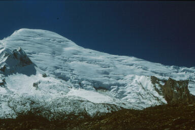
On 29th May we pitched our summit camp at Kalindi Khal (19800ft) by digging 3ft of snow. It was a windy the whole night. We thought that if the same situation continued next day then we should be traveling down to Arwa Tal since we had time limitation. Due to the windy situation I asked our guide to stay in our tent as light weight could cause him to fly away given the heavy wind blow at night. We were all waiting eagerly for the wind to calm down and atlast we were lucky that finally at 4:00am next morning it was completely calm. We roped up and started our summit journey by 5:15am. We summitted 20200ft on the loosely rock peak of Kalindi. The higher side was too risky to climb so we backed out almost 50ft below the main peak. We took some photographs with our banner and nearby peaks from top. We had spend almost 15 min and then returned to Summit camp. While returning at one place where there was a gradient of 75 degree, I tumbled down 5ft due to rope entanglement in a rock which made me loose balance and slip down. While tumbling down I was not at all frightened as I was confident that my fall would get arrested, it was possible as all 4 of us were roped up and also with our experience in such situations. While falling I shouted loudly and within no time Milind and our guide anchored themselves by laying down with ICE AXE. I too took control later by anchoring my ICE Axe in the snow. I really enjoyed my fall as it was one kind of experience in its own and thanked NIM Institure where we were all trained for our mountaineering skills. It was really cool. On 31st May, we travelled down from Arwa Tal camp to Ghatsoli where the ITBP checkpost existed. While leaving our cook was able to manage and prepare breakfast somehow due to problem in our stove. We were supposed to do formalities like inner line permission clearance from ITBP. As soon we reached Ghastoli, our cook and helper started repair work of the stove but were unsuccessful. I suggested we request ITBP people to help come out of this crisis since we didn't have our packed lunch or anything on the way. We went to ITBP Post across the river. I thought initially that due to the hype made by all people it will be very tough to handle these ITBP personnels. To my surprise a person from PWD Mr. Negi welcomed us with great enthusiasm since we were the first party of 2001 crossing this route. He served us hot tea. Then he called the post commander and introduced us to him. To our surprise they welcomed us quite differently. They called us in their fiber hut which was too warm with the bukhari. They registered our names and checked the permission documents. When informed them that we had a food problem, the commander Mr. Yadav busted with eager saying "why didn't you inform us in the beginning". So he ordered some tea and snacks for us. We spend some time since we did not require to pitch tents as ITBP offered us to stay at their place. We had good dinner after so many days with ITBP. Next day morning after breakfast Mr. Yadav and his other colleagues did see us off. We were to happy with the situation. This is how Indians are, we were too proud of all these people who take care our borders and ultimatley India. I love my India. Peaks around this area: Shivling,
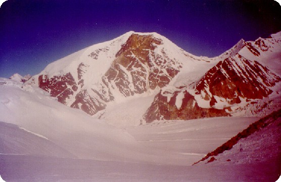
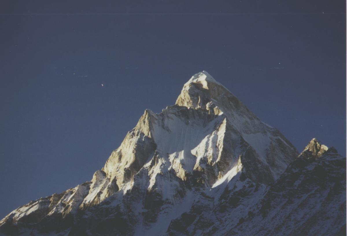
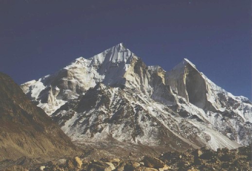
Kedardome,
Bhagirathi,
Sumeru
Places that can be explored at Badrinath : Gangotri Temple:
One of the holy places out of 4 Dham's. Vasuki: Vasuki
Tal Places can be explored at Badrinath : The Vyas Gufa near Mana village, is a rock-cave where Ved Vyas is believed to have composed the Mahabharata and the pauranic commentaries. Bhimpul on the other side of Mana village, is a massive rock forming into a natural bridge, that lies over the roaring Saraswati River. It presents a spectacular view of water thundering down through the narrow passage under the rock and is believed to have been placed there by Bhima, the second eldest among the five Pandava brothers. Vasundhara, as the name suggests, is a magnificent waterfall with a height of 122m. This place is 5km from Badrinath out of which 2km is motorable upto Mana, the last Indian village on the border. Photo Galary:
|
|
|
|
|